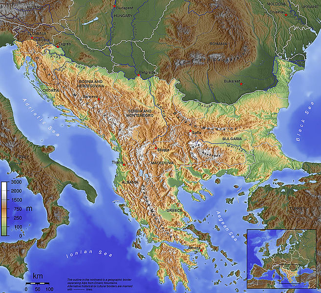
Fichier:Balkan topo en.jpg
Apparence

Taille de cet aperçu : 657 × 600 pixels. Autres résolutions : 263 × 240 pixels | 526 × 480 pixels | 840 × 767 pixels.
Fichier d’origine (840 × 767 pixels, taille du fichier : 638 kio, type MIME : image/jpeg)
Historique du fichier
Cliquer sur une date et heure pour voir le fichier tel qu'il était à ce moment-là.
| Date et heure | Vignette | Dimensions | Utilisateur | Commentaire | |
|---|---|---|---|---|---|
| actuel | 14 novembre 2015 à 09:15 |  | 840 × 767 (638 kio) | SilentResident | Corrected mistake in which the Aegean and Ionian islands were marked as part of the Balkan topography. |
| 1 février 2012 à 21:53 |  | 1 384 × 1 264 (726 kio) | Ras67 | losslessly cropped with Jpegcrop | |
| 1 février 2012 à 21:52 |  | 1 384 × 1 264 (726 kio) | Ras67 | losslessly cropped with Jpegcrop | |
| 14 avril 2006 à 17:34 |  | 1 400 × 1 278 (748 kio) | Captain Blood~commonswiki | labels | |
| 2 avril 2006 à 17:22 |  | 1 400 × 1 278 (748 kio) | Captain Blood~commonswiki | Una border | |
| 1 avril 2006 à 19:38 |  | 1 400 × 1 278 (741 kio) | Captain Blood~commonswiki | {{Bild-GFDL-GMT}} |
Utilisation du fichier
La page suivante utilise ce fichier :
Usage global du fichier
Les autres wikis suivants utilisent ce fichier :
- Utilisation sur af.wikipedia.org
- Utilisation sur ang.wikipedia.org
- Utilisation sur an.wikipedia.org
- Utilisation sur ar.wikipedia.org
- الجبل الأسود
- كوسوفو
- البلقان
- صربيا
- بلقنة
- جنوب شرق أوروبا
- أساطير الإغريق
- قالب:دول البلقان
- تاريخ البلقان
- مفاوضات بلغراد وبريشتينا
- اتفاقية بروكسل (2013)
- مستخدم:M sh شراونة محمد
- السياحة في الجبل الأسود
- مستخدم:علي العالم
- ويكيبيديا:مشروع ويكي البلقان/المشاركون
- مستخدم:صندوق مستخدم/مستخدم مشروع ويكي البلقان
- الوقف في دول البلقان
- Utilisation sur arz.wikipedia.org
- Utilisation sur ast.wikipedia.org
- Utilisation sur be-tarask.wikipedia.org
- Utilisation sur bg.wikipedia.org
- Utilisation sur bn.wikipedia.org
- Utilisation sur bs.wikipedia.org
- Utilisation sur ca.wikipedia.org
Voir davantage sur l’utilisation globale de ce fichier.


